 Live Music Archive
 Librivox Free Audio
 Metropolitan Museum
 Cleveland Museum of Art
 Internet Arcade
 Console Living Room
 Books to Borrow
 Open Library
 TV News
 Understanding 9/11
(Table of Contents to) Atlas Classique De La Geographie Ancienne, Du Moyen Age Et Moderne, A l'Usage des Colleges et des Pensions, Pour Servir A L'Etude De La Geographie Et De L'Histoire, Par V. Monin, Ingenieur-Geographe, Membre De La Societe De Geographie. Nouvelle Edition, Augmentee D'Un Tableau Comparatif De La Hauteur Des Montagnes Et Du Cours Des Fleuves. Annee Scolaire 1838 Et 1839. Librairie Classique De Perisse Freres. Paris, Rue Du Pot-De-Fer-Saint-Sulpice, 8. Lyon, Grande Rue Merciere, 33. (on verso) ... Paris.-Impremerie De Decourchant, Rue D'Erfurth, 1.
Item Preview

2613e.jpg
Zoomable full resolution image available at davidrumsey.com.
This image 2613E is a part of image group 2613.000.
Describes key features of different map sheets.
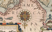
Tableau Comparatif (mountains & rivers plate) after Bulla. A very sophisticated college atlas; the table has no engraver listed but is clearly derived from or by Bulla, the author of the first table in this format published in 1826 (see Wolter article)(and see Garner's chart of 1823, our #4608). The Map of Amerique Septentrionale is by N. Lorrain. Tooley (Australia & Antarctica) lists the Oceanie map by Monin.
None found; cf Wolter p. 195.

Reviews
There are no reviews yet. Be the first one to
write a review.
